Use the resources below to research your house, neighborhood, or other property you rent or own.
Contact the Archivist with any questions.
Online
Waltham City Directories (1871-1990)
These are a great place to start; older editions often include a section organized alphabetically by street name.
Annual Listings (1867-1973)
Organized by ward, and then alphabetically by street. Like the City Directories, these will tell you who lived in a house over the years, including its first occupants.
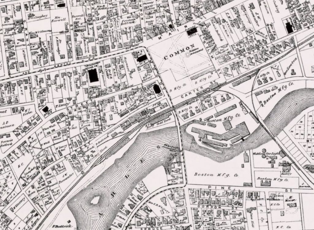
Historic maps of Waltham
These can show you what your neighborhood looked like over the years.
City of Waltham property databases
Access data such as tax, water/sewer, permit/inspectional, images, aerial photography, and property assessment.
MACRIS database
Compilation of a variety of historic information about select buildings and sites throughout Massachusetts.
MACRIS Maps
All the information from the MACRIS database, presented in a browsable map format.
Waltham Industrial Period Historic Properties Survey
2021 update of Waltham properties in MACRIS, focused on neighborhoods near the Watch Factory, the Chemistry, and the Boston Manufacturing Co. Courtesy of the Waltham Historical Commission.
Historical Survey of Homes in the Waltham Highlands
A collection of detailed house histories for select homes in the Highlands neighborhood, courtesy of the Waltham Historical Society.
Historical surveys of homes on Waltham’s South Side
Includes histories for select homes in the Chemistry neighborhood and a detailed history of land development on the South Side. Courtesy of the Waltham Historical Society.
HOLC Redlining map of Waltham
This map shows the “grades” given to Waltham neighborhoods by the federal government’s Home Owners’ Loan Corporation between 1935 and 1940. One of the major factors of determining these grades was the number of Black, immigrant, and/or working-class citizens who lived there; those neighborhoods were given lower grades. Learn more at the Mapping Inequality project.
Mapjunction
Compare any two maps of Greater Boston from 1630 to the present. Type “Waltham” in the search box to compare maps from 1770 – present.
City of Waltham Building Department
This department keeps records of when houses were built and what renovations (ones that needed permits) have been done over the years.
At the Library
Waltham City Directories (1871-1990) and Annual Listings (1867-2017) Some dates available by appointment only
Historic maps of Waltham
See Maps and Plans PDF and Maps with Houses Shown PDF for lists of maps available by appointment
Materials on various neighborhoods and historic houses
See Historic Homes and Buildings collection guide; available by appointment only
Sanborn maps (1867-1970) In-library use only
Maps from every city and town in Massachusetts that include detailed information about individual buildings and properties